
One of the thirty-eight districts that make up the Indian state of Bihar is Rohtas. It was created in 1972 after Shahabad District was divided into Bhojpur & Rohtas. Sasaram serves as the district’s administrative center. Bihar’s Rohtas district has the highest level of literacy.
Of the 38 districts in Bihar, the Rohtas district has one of the highest forest cover rates. The approximate travel distance from Patna to Rohtas is 160 KM and minimum travel time is 4 h 7 mins.
About Rohtas
The district’s economy is based on agriculture. The main crops are maize, wheat, and paddy. The “Rice Bowl of Bihar” is Rohtas. Dalmianagar was a significant industrial city in India up until 1980. The factories (Rohtas Industries) that produced sugar, vegetable oil, cement, paper, and chemicals are now closed.
Rohtas has a lengthy & fascinating past. The district’s plateau terrain has been home to indigenous people since prehistoric times. The Bhars, Cheers, and Oraons are today’s top representatives of these people. Some lore claims that the Kherwars were the first settlers in the hilly areas close to Rohtas.
During the monsoon, more than 200 waterfalls may be seen in Rohtas and Kaimur. According to Abu’l Fazl, a court historian of the Mughal Emperor Akbar, “Ain-i- Akbari,” a book he wrote, “approximately more than 200 waterfalls appear in Bihar in the rainy season.”
History Of Rohtas
Rohtas has a lengthy & fascinating past. The district’s plateau terrain has been home to indigenous people since prehistoric times. The Bhars, Cheers, and Oraons are today’s top representatives of these people. Some lore claims that the Kherwars were the first settlers in the steep areas close to Rohtas.
The Oraons assert that they were in charge of the region between Patna and Rohtas. The Sasaram, the administrative center of the Rohtas district, is linked to King Sahasrabahu according to local folklore. Sahasrabahu is thought to have died as a result of a horrible altercation he had with Saint Parsuram, the fabled Brahmin Protector.
Sahasrabahu and Parsuram are said to be the ancestors of the word Sahasram. Another tale links Rohitashwa, the son of Raja Harishchandra, to the Rohtas hill.
Pre-Mauryans ruled the Bihar region of Rohtas from the sixth to the fifth centuries BC, during which time it was a component of the Magadha Empire. A little granite edict from Emperor Ashok that dates to the time of the Mauryan control over this region may be found. Huge upheavals were caused by the mutiny in 1857 in Rohtas. In 1972, Rohtas, which had previously been a part of the Shahbad district, became an independent district after India attained independence.
Rohtas Weather
Given that Rohtas’ climate is characteristic of the North Indian plains, it is pleasant to travel there from October to May.
Geography
The Rohtas district covers 3,851 square kilometers (1,487 sq. mi). As a result, it is Bihar’s fourth-largest district
Two significant natural regions may be distinguished in the Rohtas district. The Sasaram Plain is an alluvial plain in the north and northeast that slopes gradually downward toward the northeast. In the north, it is 72 meters above sea level; in the south, it is 153 meters above sea level. All of the blocks in Dinara, Dawath, Bikramganj, Nasriganj, Nokha, and Dehri, as well as a portion of the blocks in Sasaram, Sheosagar, and Rohtas, are covered by the plains. In the Sasaram Block to the east, there are sporadic wooded areas.
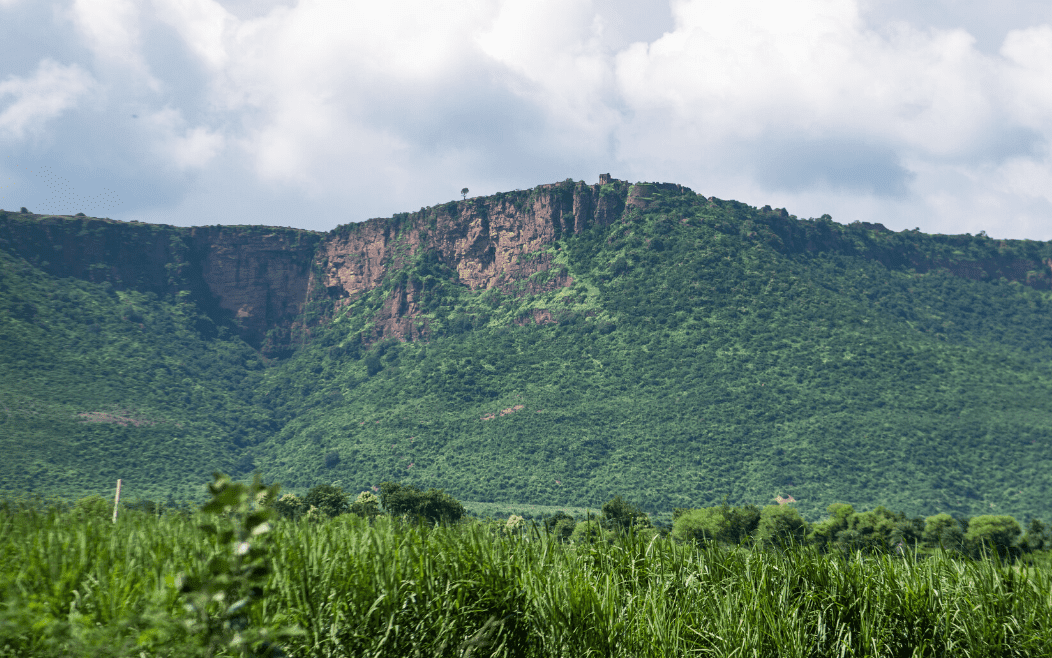
The Rohtas Plateau, an eastern edge of the Vindhya plateau with an average elevation of 300m above sea level, is located in the southern section of the district. It includes a portion of the Chenari, Nauhatta, Rohtas, Sheosagar, and Sasaram Blocks. There are a few scattered woodlands across this hilly terrain. The Durgawati, Bajari, Koel, and Sura are just a few of the streams that run north. Due to its uneven, rocky, and gravelly soils as well as its dense forest cover, the Rohtas Plateau is less suitable for cultivation. Pear grass, kus, and khas khas are just a few of the tall grasses that naturally cover the plateau.
Ustalfs, ochrepts, orthents, fluvents, and psamments are the five main types of soils found in the Rohtas district.
Why Visit Rohtas?
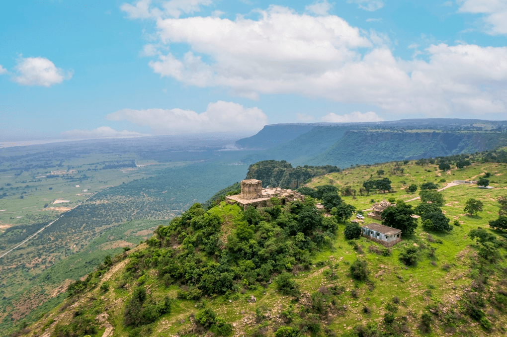
The locations that give Rohtas its attractiveness is Shergarh Fort, which Hassan Shah Sur erected, Tarachandi, which has a lovely temple, Sasaram, where the gorgeous mausoleum of Sher Shah Suri is located, and Rohtasgarh Fort, which is a noteworthy example of Mughal-era architecture. Along with its abundance of historical sites, Rohtasgarh is home to important religious sites.
In Rohtasgarh, there are a few temples and a masjid. There is the gurdwara of Chacha Fagumal Sahib Ji, which is a revered location. Akbarpur, Rehal, Deo Markandey, Bhaluni Dham, Akhorigola, Dhruwan Kund, and Gupta Dam are further tourist hotspots. Given the locations, Rohtas tourism is utterly lavish.
Transportation
Sasaram is now easily accessible by air, rail, and road from the majority of the country’s major cities.
By air: The closest airport near Sasaram is in Gaya, which is 97.4 kilometers away.
By train: The Sasaram Railway Station is the closest train station near Sasaram and approximately 100 kilometers from Varanasi.
Sasaram is located on the Indian Railways’ Grand Chord Section (Howrah-Gaya-Delhi route). Regular trains go to Sasaram from other significant cities around the nation.
Sasaram Junction (SSM), Dehri-on-Sone (DOS), and Bikramganj are significant railway stations (XBKJ)
By road: Bus services, both public and commercial, connect the city with other towns in the state on a regular basis.
From Sasaram, the Grand Trunk Road (NH-2) passes. Major cities like Patna, Ara, Bilaspur, Varanasi, New Delhi, Kolkata, Bokaro, Jamshedpur, etc. are easily accessible from Sasaram.
Places to explore in Rohtas
1. Chaurasan Temple:
It takes roughly two hours to go from Rohtas Block Headquarters to this stunning historic temple, which is close to Rohtasgarh Fort. The name Chaurasan refers to the 84 stairs that lead up to this Lord Shiva temple.
King Harishchandra had erected the temple. On the occasion of Shivratri, a significant number of visitors go there. At this temple, people conduct fasts and make respectful prayers.
2. Karamchat Dam:
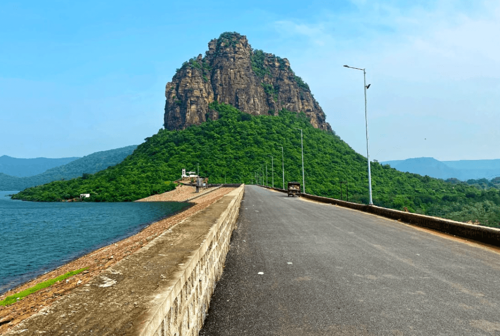
About 35 kilometers from Sasaram is one of the most popular tourist destinations in the Rohtas area, which is close to Chenari. In fact, the dawn and sunset views are breathtaking and captivating.
The “Durgawati Reservoir Project” was envisioned to irrigate the unirrigated areas of the Rohtas plains following the severe famine in 1966.
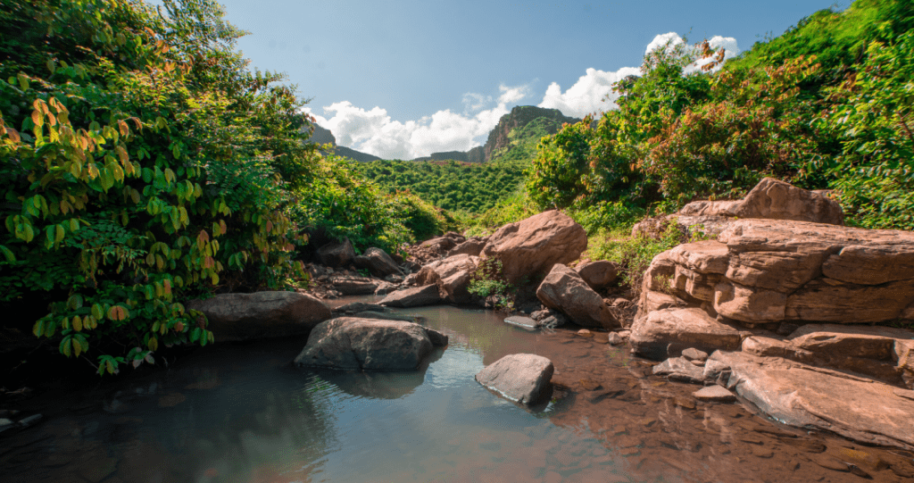
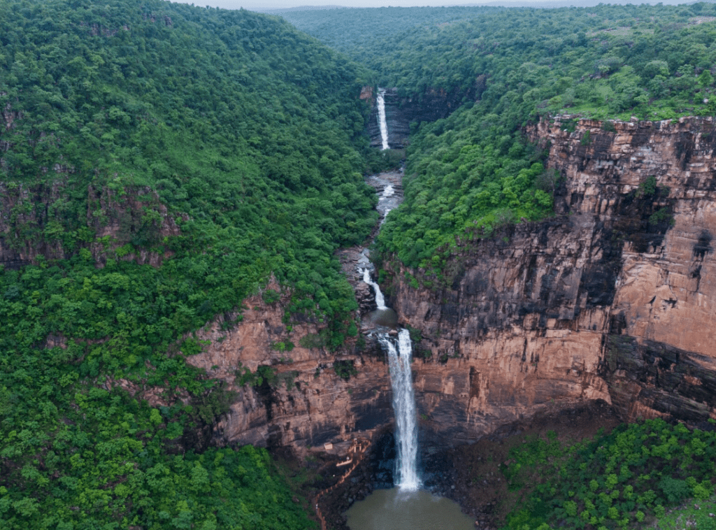
3. Dhuwan Kund:
Waterfalls Dhuan Kund is located on Kaimur Hill, 10 kilometers from Sasaram. The Guru Granth Sahib was traditionally carried, according to ancient history. Sikh community members used to spend three days on the Manjhar Kund. The water of the Kund is considered to be rich in natural minerals and extremely beneficial for digestion.
It is the most picturesque location in Sawan. The first Sunday following the holiday of Raksha Bandhan is traditionally when a fair is held.
4. Kaimur hills:
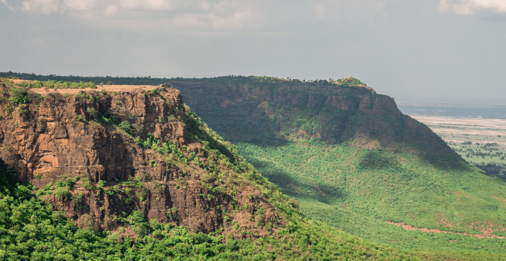
The Hills of Kaimur continue to evoke a sense of mystery with their deep forests, gorges, stunning waterfalls, and strewn-about antiquarian ruins. The Hills, which make up the easternmost portion of the Vindhya Range and extend from near Katangi in Jabalpur (Madhya Pradesh) to near Sasaram in Rohtas (Bihar), have served as a shelter for human activities since the most ancient of times.
One can still find many signs of these activities today, including prehistoric rock shelters that date back as far as 10,000 B.C.
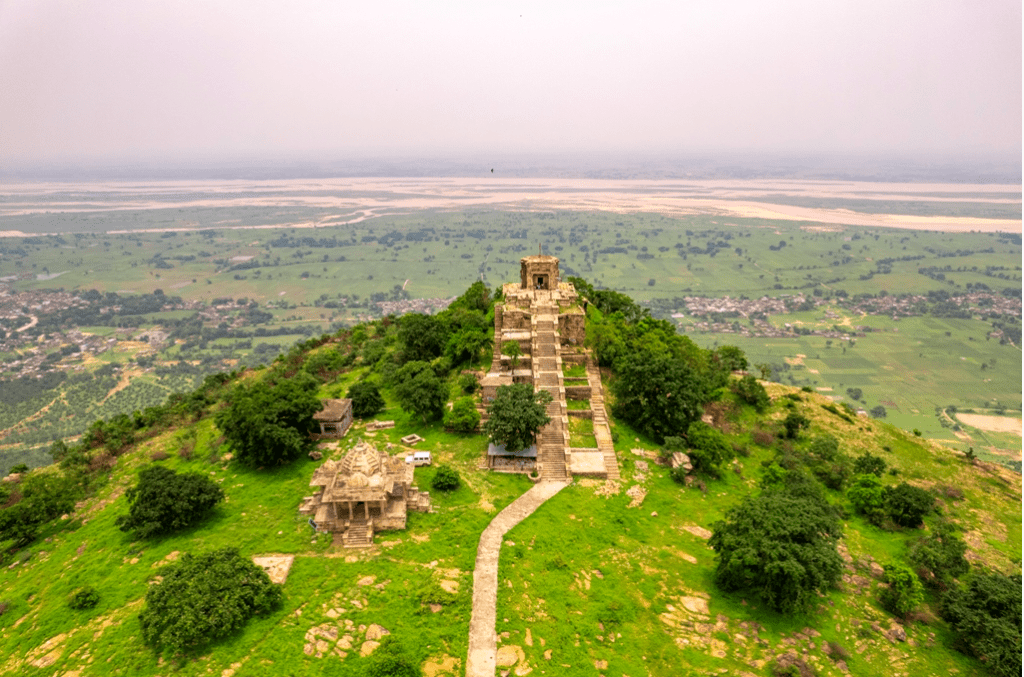
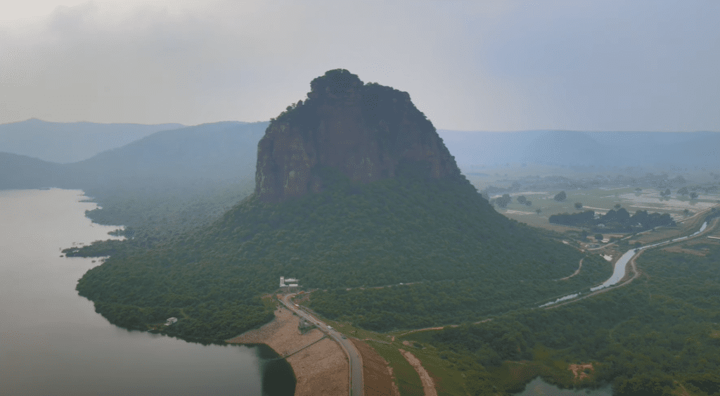
5. Rohtasgarh Fort:
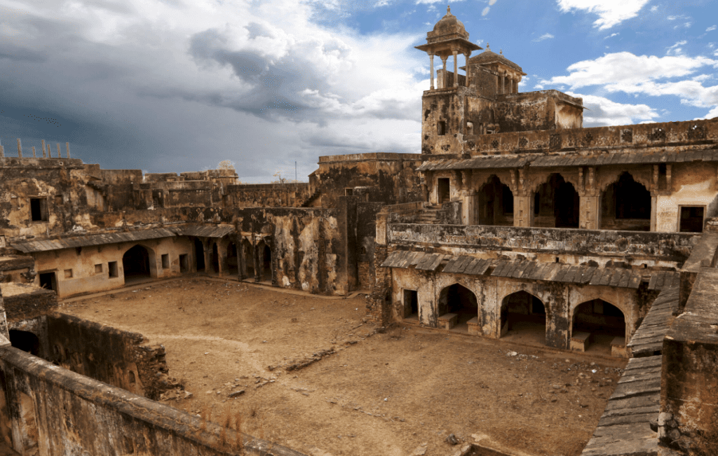
On a plateau atop a hill with sharply rising slopes, the Rohtas Fort is built. The limestone of the hill has been carved into stairs up to the fort. The fort’s residents could defend themselves against any opponent besieging the fort for months in the past because of the numerous streams that traversed the plateau and the fertile soil, which made it simple for crops to grow.
The hill was surrounded by dense forests, wild animals, and other man-made obstacles like dacoits in the past. As a result, the fort, which was thought to be unconquerable, could only be seized by trickery rather than by force.
6. Sher Shah Suri Tomb:
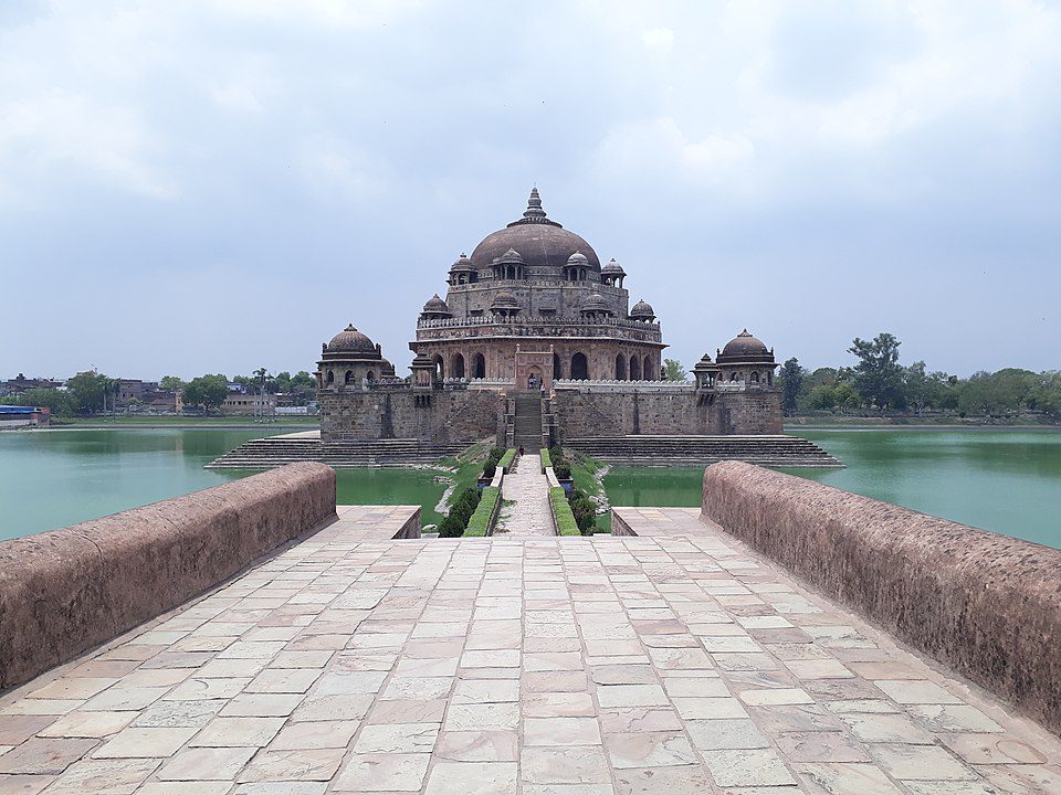
The Sher Shah Suri Tomb is located in the Bihar district of Rohtas in Sasaram. The mausoleum of Sher Shah Suri is a magnificent example of historic construction. Large open courtyards, tall domes, and pillars are examples of its Indo-Islamic architectural features.
There are hints of Afghan architecture as well. This stunning building is a three-story mausoleum (approximately one hundred and twenty-two feet). It is located in the centre of a square-shaped artificial lake.
7. Tutla Bhawani:
It is possible to locate Tutla Bhawani, also called Tutrahi or Titula Dham, close to Tilauthu and about 20 (km) southwest of Dehri-on-Sone. These two substantial mountains lie to the northwest and southeast. Two massive mountains, one from the northwest and the other from the southeast, collide to make a lush valley that spans for one mile, has a spring and a fall in the midst, and a river named the Kachuar flows from it.
This creates a fascinating scene where the valley appears to extend 300 meters to the east but then narrows to only 50 meters to the west, creating a spring fall that is 200 meters high.
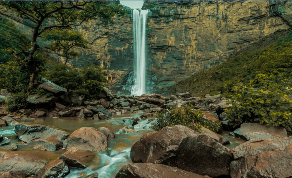
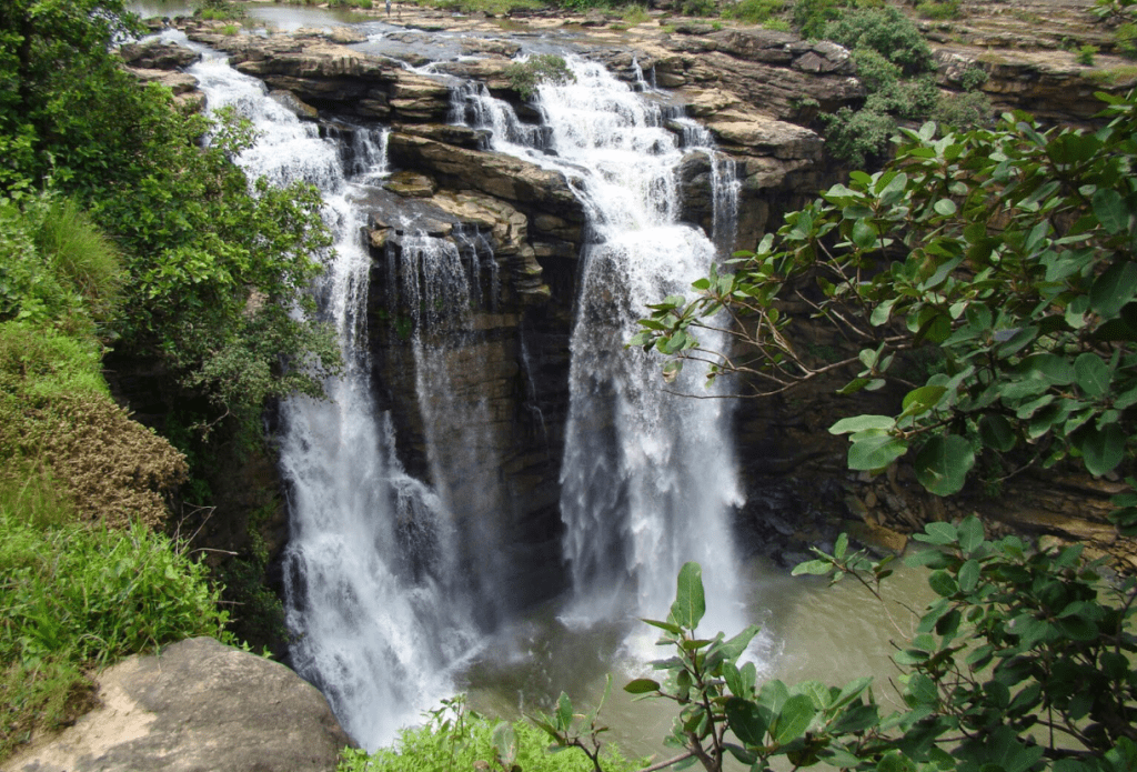
8. Kashish Waterfall:
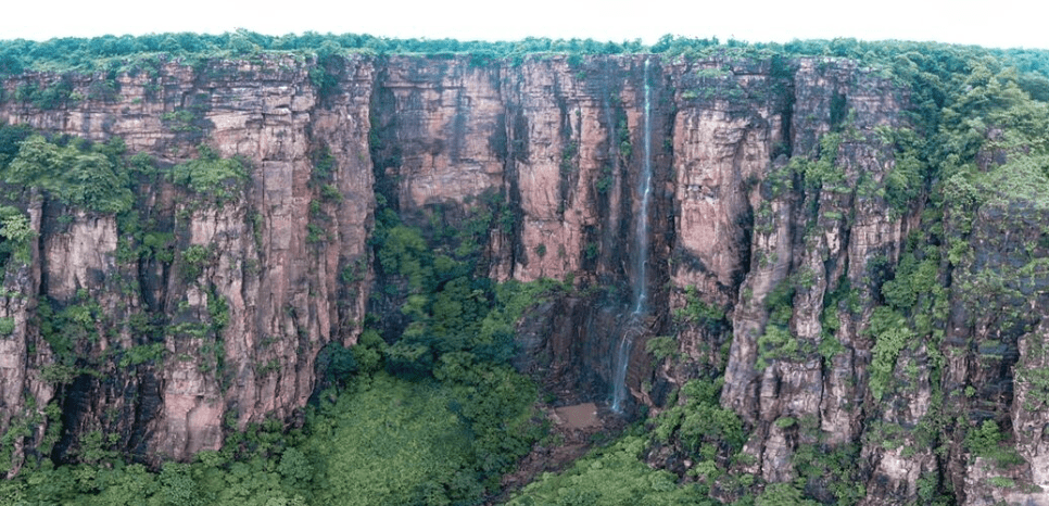
170 kilometres from the state capital Patna, in the Rohtas district of Bihar, is the stunning and alluring Kashish Waterfall. From Patna Junction, the travel takes roughly 5 hours.
Kashish is one of more than 200 waterfalls that arise in Bihar during the rainy season, according to Ain-i- Akbari (administration of Akbar). The court historian of the Mughal Emperor Akbar, Abu’l Fazl, wrote this book in Persian.
The waterfall is around 800 feet high, and according to the locals, there are four other waterfalls that flow from the mountain in three different directions. When Aristotle observed, “In all things of nature there is something of the amazing,” The location’s breathtaking splendor tells a fairytale-like story about nature.
Undoubtedly, the dawn that follows the day creates a lovely atmosphere. The smoky horizon and the clouds full of sunrays with a drawing quality intertwine and peep out of the creek with a serene smile.
Best time to visit
The best time to visit Sasaram is in the winter or after the rainy season when the temperature is still comfortable.
Different route from Patna to Rohtas
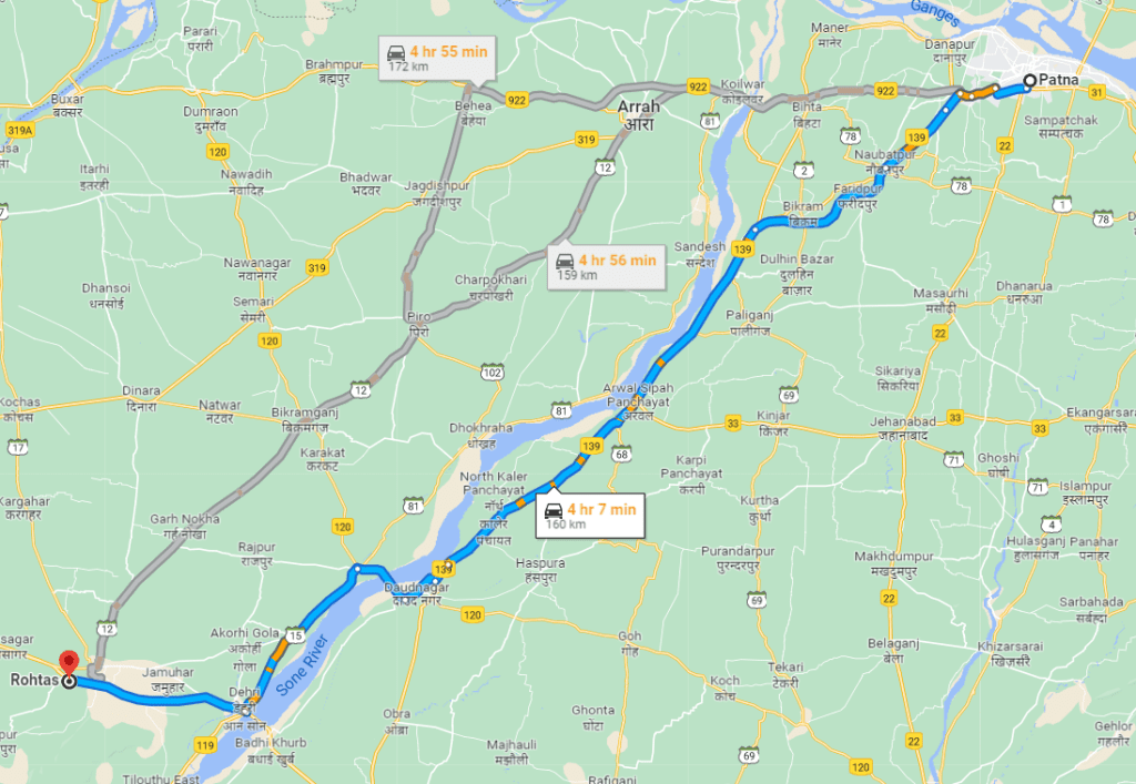
Starting at NH 139, the first route goes through Naubatpur, Faridpur, Saidabad Kanpa, Chainpura, Arwal Sipah, Baidrabad, Shamshernagar, Dehri, Parasia, Nabinagar Rd., and lastly Rohtas. It will take 4 hours and 7 minutes to drive the full 160 kilometres.
The second route begins at NH 922 Kanhauli and proceeds through Kateshar, Koilwar Bridge, Sarangpur, Buxar-Patna Road, Saraiya, Madhubani, Dubauli, Jagdhishpur, Kamariyava, Piro, Bikramganj, Sasaram, and Khaira before ending at Khaira. The entire travel distance would be 172 kilometers, and the estimated driving time would be 4 hours and 55 minutes. The longest route is also the most picturesque and filled with exciting side trips.
What Are the Things to Keep in Mind While Traveling by Road?
There are a few things you should keep in mind while traveling by road:
- first, plan your route. Decide where you’re going to stop and take breaks, and map out the gas stations and rest stops along the way.
- second, pack an emergency kit. Bring a first-aid kit, a flashlight, a map, and some snacks.
- third, be aware of the weather. If it’s going to be hot, make sure you have enough water. If it’s going to be cold, pack some extra blankets.
- finally, relax and enjoy the ride!
Conclusion
You now know everything you need to get from Patna to Vaishali by road. All that’s left to do is book your cab and get packing!
We hope this travel guide has been helpful. If you have any questions or suggestions, please don’t hesitate to contact us. We wish you a safe and enjoyable journey!
Book Now at 9263774117